
Walk a Mount Vernon Street Directory
Use an address trail in a fixed order. The Mount Vernon Assessment roll and the county parcel layer identify the property and its tax-map key. That key makes a land-record search far safer than a surname alone. A deed can establish a transaction, while a directory or election record may offer a dated address association. Neither source should be made to prove more than it says.
- Enter the complete address, apartment or floor if known, ZIP, and an approximate year. Find the property in the assessment roll or county GIS, then copy the parcel key exactly.
- Record the property location and current owner mailing field separately. A mailing field can point away from the property, so it is not evidence that the owner occupies the address.
- Search Westchester Records Online for the owner as grantee. Match the premises or legal description before treating an instrument as part of the parcel's chain.
- Use the New York voter lookup only for a narrow status check with its required identity and address information. It is not a street-browsing list.
- For an earlier household, ask the local-history room whether a reverse or criss-cross directory is available, then compare the printed address with its directory year.
This street directory sequence puts the stable parcel first, then the owner field, deed chain, constrained voter check, and historical directory lead. It limits false matches on Mount Vernon blocks where identical surnames or close house numbers can recur.
Mount Vernon Parcel Keys by Address
The public 2025 final assessment roll is a row-based PDF, not an owner-search application. It is still a strong starting document for a Mount Vernon street directory search because each row joins a property location to a tax-map parcel ID, class, owner field, school information, exemptions, and values. Search the PDF text by the printed street name or parcel key, then inspect nearby rows in case extraction has separated names and addresses. The sample reviewed in the source uses parcel 164.75-1058-6 at 28 MacQuesten Parkway South.
The roll is useful for parcel identity, but it is not a complete parcel card. It does not supply a full building sketch or every past transfer. The following field inventory keeps the record's own labels clear when notes are made from the roll and the GIS service.
| Field | Record or layer | How to use it |
|---|---|---|
Tax-map parcel ID / SWISSBL | Assessment roll and GIS | Keep the key as the anchor for a deed, permit, or parcel comparison. |
| Property location and class | 2025 roll | Separate the physical property from the owner mailing field. |
| Current owner name and address | 2025 roll | Use the spelling as a land-index lead, not as an occupancy conclusion. |
PROPADDRESS, LOC_ST_NBR, LOC_STREET | County GIS layer | Filter or inspect the street segment by its address components. |
PROPZIP, PROPERTYCLASS, school fields | County GIS layer | Compare the local parcel attributes before recording a ZIP or district. |
Note: The assessment roll identifies a municipal tax record, while the assessor remains the source for authoritative assessment questions.
Map Mount Vernon Addresses
The Mount Vernon layer in the Westchester GIS service is the practical map companion to the PDF roll. Its fields include PROPADDRESS, PROPAPT, PROPCITY, PROPZIP, PROPERTYCLASS, LOC_ST_NBR, LOC_STREET, school fields, SWISSBL, and parcel geometry. Query, identify, find, export, and map operations can help separate a corner, rear, or adjoining parcel from another address on the same street.
The county parcel-layer listing shows the Mount Vernon attributes used for an address-level map check.
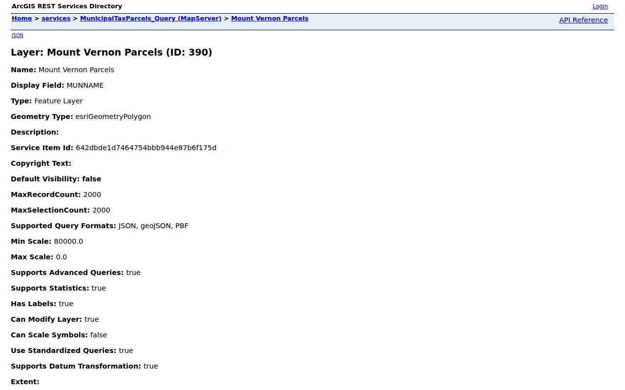
Geometry makes adjacent parcels visible, but the service says its parcel boundaries are approximate and not surveys. Confirm a disputed boundary or formal property description with the local assessor or the appropriate recorded source. The service metadata also notes a 2,000-record maximum, so a large street query may need a narrower address or map selection.
Follow Mount Vernon Deed Records
Westchester Records Online, often called WRO, is the County Clerk route for current land research. It covers Land, Legal, Maps, and Trades-related functions, with deeds, mortgages, maps, judgments, and related filings described on its landing route. A new user may need to register for images. Search the current owner as grantee, inspect the instrument date, grantor, grantee, document type, premises or legal description, consideration when visible, and book, page, or index reference. Then search the prior grantor as an earlier grantee.
For a longer chain, the Westchester Archives research-by-mail service publishes grantor and grantee indexes from 1680 through 1907 and mortgagor indexes from 1680 through 1897. The Archives also offers an individual-record request for $15 or custom research at $25 per hour, paid in advance by U.S. check or money order. Use WRO for the current index, the Clerk's Land Records Division when a document needs direct help, and Archives staff when the online route or image access is insufficient.
Do not turn a deed date into a move-in date. An estate, trust, corrective deed, refinancing, split, merger, or delayed recording can change a land-record name without showing who lived at the address.
Note: Preserve the parcel key and instrument citation because an address can change while a land record still describes the same property.
Mount Vernon Buildings by Block and Lot
The Mount Vernon Buildings Department is the city route for permits, violations, certificates, applications, plans, and related property actions. These records can help explain a physical change that appears in a parcel, deed, or historical address trail. They do not create a list of everyone associated with an address. Bring the block and lot from the tax map, because the city's published search instructions require that identification.
The Gateway property portal presents categories for property information and title searches, certificates, multiple-dwelling records, applications, permits, plans, reference-number status, documents, amendments, payments, and street-opening permits.
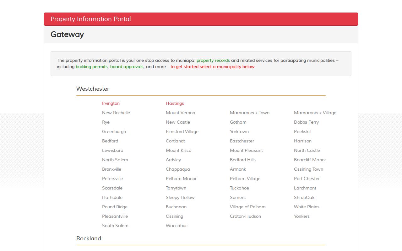
Use the category page to identify the appropriate request type, then capture the actual city form before relying on a field-by-field online workflow. The public entry page does not establish a full historical online coverage range.
The Buildings Department page is the official starting point for the department's record categories and inspection-related services.
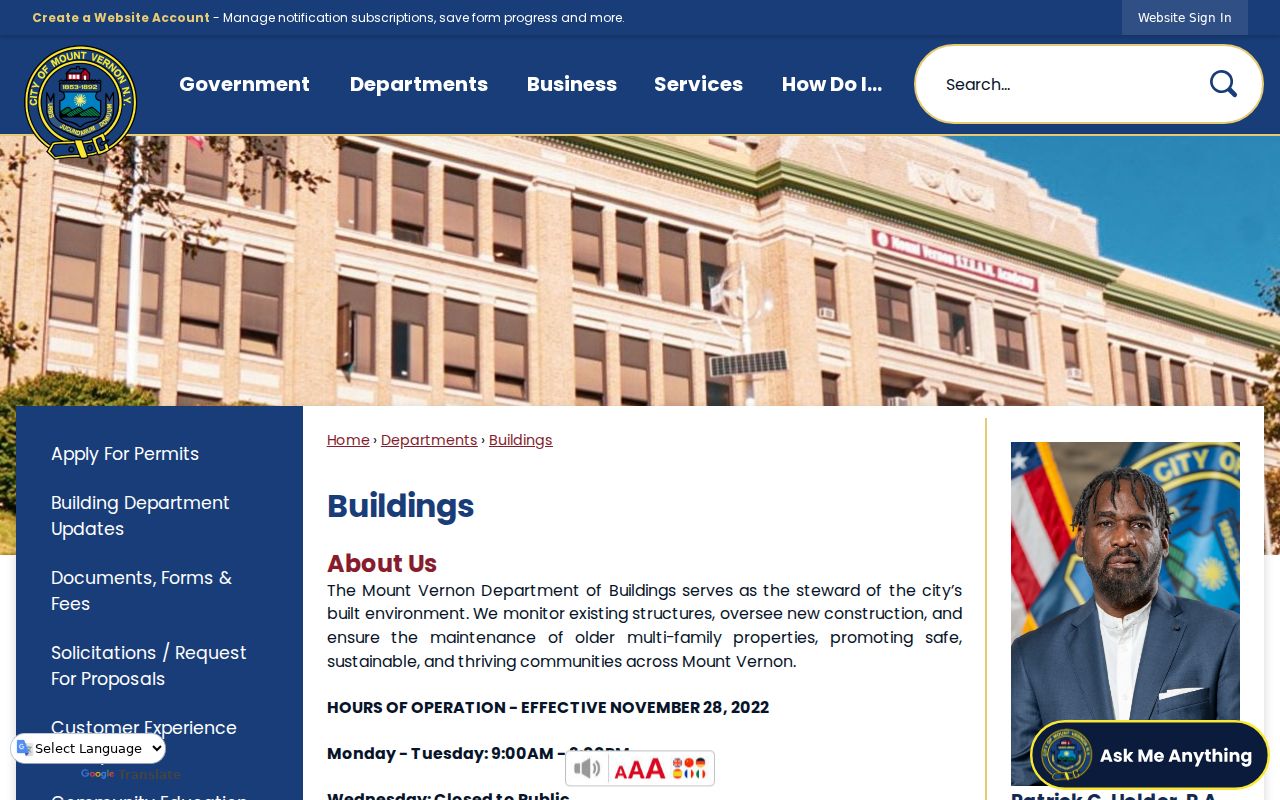
Pair a city property action with the parcel key and date window. That precision helps the department locate a defined record and prevents a property-record note from overstating what a permit file proves.
Mount Vernon Address Records by Street
Address-keyed sources answer different questions. The roll supplies a present municipal parcel view; GIS supplies map geometry and layer fields; land records supply transactions; city files can identify defined property actions; and old printed sources can associate a name with a date. A voter status tool is deliberately narrow. Keeping those roles separate makes a local address result easier to verify.
| Address record | Custodian | Useful fields or result | Access route |
|---|---|---|---|
| Assessment roll | Mount Vernon Assessment | Location, class, parcel ID, owner field, mailing address, exemptions, school, value | 2025 PDF and current roll links |
| Municipal tax parcels | Westchester County GIS | Address parts, ZIP, class, school, SWISSBL, geometry | Online query, identify, find, export, and map service |
| Land instruments | Westchester County Clerk | Grantor, grantee, premises, instrument, date, book/page or index reference | WRO, Land Records Division, then Archives for older work |
| Buildings records | Mount Vernon Buildings Department | Permits, applications, plans, certificates, violations where held | Portal categories, department search, or defined FOIL request |
| Historical address leads | Library and regional repositories | Printed name, street/number, household notation, notice, or map footprint | Directories, newspaper microfilm, maps, and staff assistance |
The New York voter system requires last name, first name, date of birth, county, address, and ZIP, and depends on cookies and JavaScript. Its successful result can show status and polling information, but it is not a public browse of people along a street. Election-data inspection or requests carry election-purpose and privacy rules.
Note: A result from one address source should be compared with a second dated record before a household connection is treated as reliable.
Street Terms for Mount Vernon Records
Use the same vocabulary in notes from the roll, map, deed index, and historical directory. A defined term avoids merging a property fact with a household fact.
- Parcel
- A tax-mapped unit of property. Its identifier is often more stable than an address when land is split, merged, or renumbered.
- Situs address
- The physical property location. It can differ from the owner's mailing address shown on the assessment roll.
- Plat or map reference
- A recorded map or lot reference used to describe land. It can be more reliable than a changing street number in an older instrument.
- Criss-cross directory
- An address-to-name directory format. The public sources do not confirm a Mount Vernon title or run, so ask the local-history room before assuming one is available.
For printed historical leads, the Mount Vernon local-history guide identifies the Virginia McCullen Moskowitz Local History Room and a newspaper route. Its published details differ slightly from a regional library listing, so call before visiting to confirm the entrance and hours.
Mount Vernon Streets Before 1892
Older address research needs a jurisdiction check as well as a street check. Mount Vernon incorporated as a village in 1853 and as a city in 1892 under Chapter 182 of the Laws of 1892. Earlier material may use Eastchester, a village label, a county locality, or a farm or manor description instead of the modern city wording. Preserve the place name printed by the source and add the present interpretation separately.
No reliable citywide renumbering or renaming year was located in the reviewed sources. Test number variants, suffixes, old street forms, maps, deeds, directories, and library files rather than assuming modern numbering is continuous. The 1918 Sanborn set is useful for the physical block, while a dated directory or deed is needed for a person or transaction connection.
Note: A historical street label is a search term to test, not proof that it is identical to a modern municipal address.
FOIL for a Defined Street File
When a city file is not published through the ordinary route, use the Mount Vernon FOIL online form for a narrow request. The form asks for a full name, address, phone or email, a description of the records, document or date details, address or time-period details, a preferred inspection, photocopy, or electronic-if-available option, and an electronic signature and date. A focused request might seek final permits and certificates for one address and parcel within a stated period.
The Buildings forms and fees page lists $125 searches for one property's violations, certificate or letter-of-completion records, and permits/applications. Copies are $0.25 per page. It repeats the need for block and lot information. The city says its FOIL process can take up to 20 business days and longer for extensive requests; New York FOIL remains a route for existing records, not a way to create a search or override protected material.
The published fee schedule gives the defined categories and copy charge used when planning a property-record request.
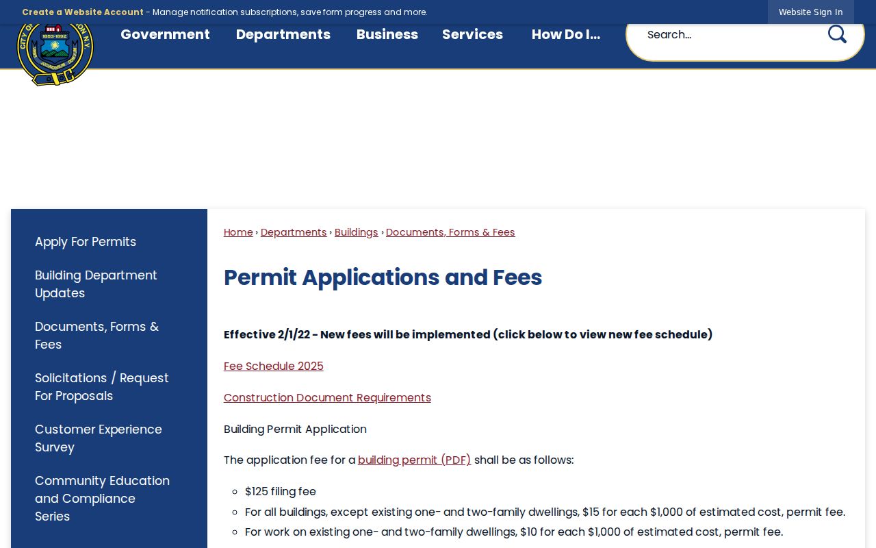
Save the request, acknowledgment, promised date, response, and any citation together. That record trail distinguishes an unlocated file from a file held by a different custodian.
Note: A narrow request is easier to track because it names one record series, property identifier, date range, and requested format.
By-Street Limits in Mount Vernon
A property owner field, a deed grantee, and a historical directory entry each describe a different connection to an address. They do not prove a current household. The assessment roll may show an off-site mailing address, a corporation, an estate, a trust, or a public agency. A directory is a printed snapshot for its publication year, and a voter lookup can fail because of a spelling, address, date-of-birth, or registration-status mismatch.
The address chain narrows a parcel question. For a historical printed-household question, use the dedicated Mount Vernon city directories resource, then compare its date with a deed, map, newspaper, or census source. Never turn a street list into a statement that every named person lives there now.
Lawful use. Use Mount Vernon address records only for personal, lawful research and respect every protected or confidential record. Never use an address trail to stalk, harass, or intimidate anyone.